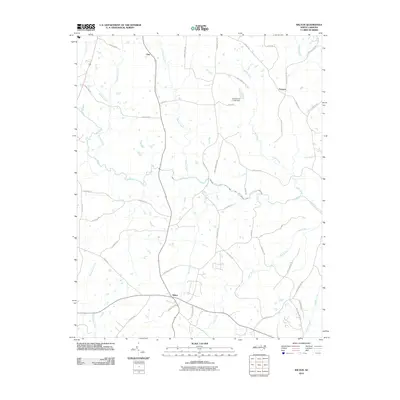
2010 Map of Wilton
USGS Topo · Published 2010About this map
The Tar River flows through the center of this rural landscape in Granville County, providing the primary drainage for numerous tributaries such as Fishing Creek and Gibbs Creek. The small settlements of Wilton, Fairport, and Clay anchor the region, connected by a network of roads that reflect early community hubs and family landholdings, including Suits Store Rd and Mack Brummitt Rd. Local infrastructure is marked by the Joe Hamme Jr Lake Dam and various creek crossings that have historically defined movement through the area.
Find a feature on this map
46 named features on this map. Tap any name to fly to it.
Don’t see what you’re looking for? This feature index may not catch every label — zoom into the map to look around manually.
Map Details
Editions of this 2010 Wilton Map
This is the sole edition of this map. No revisions or reprints were ever made.
Other maps of this area

1943 · Creedmoor
USGS Topo · 1:62,500

1944 · Creedmoor
USGS Topo · 1:62,500

1953 · Oxford
USGS Topo · 1:62,500

1953 · Greensboro
USGS Topo · 1:250,000

1954 · Greensboro
USGS Topo · 1:250,000

1962 · Greensboro
USGS Topo · 1:250,000

1966 · Greensboro
USGS Topo · 1:250,000

1966 · Oxford
USGS Topo · 1:62,500

1970 · Henderson
USGS Topo · 1:24,000
1974 · Creedmoor
USGS Topo · 1:24,000