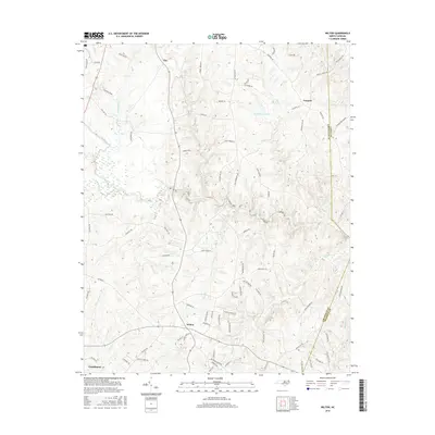
2016 Map of Wilton
USGS Topo · Published 2016About this map
Wilton and Clay anchor this portion of southern Granville County, where a complex network of waterways feeds into the Tar River. The landscape is defined by its rural road system, with family-named routes such as Tommie Sneed Rd and Mack Brummitt Rd reflecting the generational history of the area's residents. In the northeastern corner, Fairport sits near the Vance Co line, while the southern reaches of the map approach Creedmoor. Significant local landmarks include Joe Hamme Jr Lake and numerous drainage systems like Fishing Cr, Gibbs Cr, and Sand Cr that carve through the local terrain. The survey captures the quiet transition between rural farmland and the expanding residential corridors of North Carolina's Piedmont region, documented here with modern accuracy.
Find a feature on this map
84 named features on this map. Tap any name to fly to it.
Don’t see what you’re looking for? This feature index may not catch every label — zoom into the map to look around manually.
Map Details
Editions of this 2016 Wilton Map
This is the sole edition of this map. No revisions or reprints were ever made.
Other maps of this area

1943 · Creedmoor
USGS Topo · 1:62,500

1944 · Creedmoor
USGS Topo · 1:62,500

1953 · Oxford
USGS Topo · 1:62,500

1953 · Greensboro
USGS Topo · 1:250,000

1954 · Greensboro
USGS Topo · 1:250,000

1962 · Greensboro
USGS Topo · 1:250,000

1966 · Greensboro
USGS Topo · 1:250,000

1966 · Oxford
USGS Topo · 1:62,500

1970 · Henderson
USGS Topo · 1:24,000
1974 · Creedmoor
USGS Topo · 1:24,000