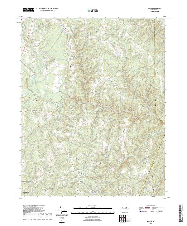
2022 Map of Wilton
USGS Topo · Published 2022About this map
Wilton serves as a central point of reference in this Granville County landscape, where the Tar River and its various tributaries define the local geography. The map illustrates a rural network of named roads such as Old Franklinton Rd and Dixon Rd that connect small settlements including Clay and Fairport. Waterways like Beaverdam Cr and Fishing Cr carve through the terrain, indicating the drainage patterns that have historically influenced land use and property boundaries in this part of North Carolina. Near the southern edge of the survey, the proximity of Creedmoor suggests the northward extension of local transit corridors. This modern topographic record preserves the locations of numerous family-named landmarks and local connectors, including Tom Hunt Rd and Cannady Rd, providing a clear view of the contemporary road network and hydrological systems.
Find a feature on this map
91 named features on this map. Tap any name to fly to it.
Don’t see what you’re looking for? This feature index may not catch every label — zoom into the map to look around manually.
Map Details
Editions of this 2022 Wilton Map
This is the sole edition of this map. No revisions or reprints were ever made.
Other maps of this area

1943 · Creedmoor
USGS Topo · 1:62,500

1944 · Creedmoor
USGS Topo · 1:62,500

1953 · Oxford
USGS Topo · 1:62,500

1953 · Greensboro
USGS Topo · 1:250,000

1954 · Greensboro
USGS Topo · 1:250,000

1962 · Greensboro
USGS Topo · 1:250,000

1966 · Greensboro
USGS Topo · 1:250,000

1966 · Oxford
USGS Topo · 1:62,500

1970 · Henderson
USGS Topo · 1:24,000
1974 · Creedmoor
USGS Topo · 1:24,000