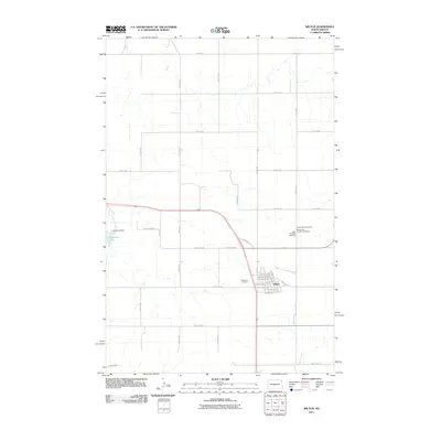
2011 Map of Wilton
USGS Topo · Published 2011About this map
The settlement of Wilton sits at a geographic crossroads in the early 21st century, with its grid of streets such as Bismarck Ave and Dakota Ave reflecting a history tied to the regional rail corridor. To the west, the landscape is defined by the managed waters of Yanktonai Creek, where the Yanktonai Dam has created Yanktonai Lake. This water management system contrasts with the more natural winding path of Burnt Creek to the southeast.
Find a feature on this map
45 named features on this map. Tap any name to fly to it.
Don’t see what you’re looking for? This feature index may not catch every label — zoom into the map to look around manually.
Map Details
Editions of this 2011 Wilton Map
This is the sole edition of this map. No revisions or reprints were ever made.
Other maps of this area

1949 · Turtle Creek
USGS Topo · 1:62,500

1950 · Wilton
USGS Topo · 1:62,500

1954 · McClusky
USGS Topo · 1:250,000

1958 · McClusky
USGS Topo · 1:250,000

1959 · Mercer SW
USGS Topo · 1:24,000

1961 · Turtle Creek SW
USGS Topo · 1:24,000

1961 · Turtle Creek SE
USGS Topo · 1:24,000

1966 · Price
USGS Topo · 1:24,000

1966 · Wilton SE
USGS Topo · 1:24,000
1966 · Sanger
USGS Topo · 1:24,000