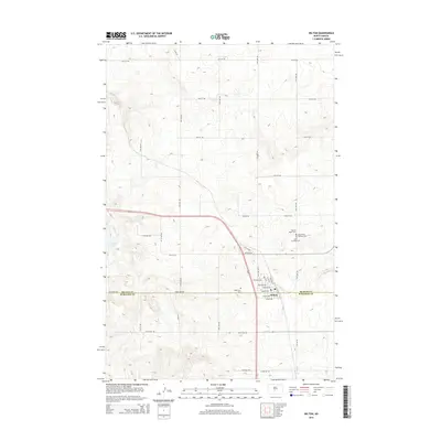
2014 Map of Wilton
USGS Topo · Published 2014About this map
Wilton straddles the boundary of McLean and Burleigh Counties, appearing here as a crossroads community defined by a grid of streets including McLean Ave and Bismarck Ave. The map reveals a high concentration of religious and memorial sites clustered northeast of the town center, including Sacred Heart Cem, Saint Nicholas Cem, and Saints Peter and Paul Cem. This arrangement suggests a settlement with deep community and denominational roots. The surrounding prairie landscape is marked by the seasonal flows of Yanktonai Cr leading into Yanktonai Lake to the west, and Burnt Cr in the south. The presence of Railroad St alongside the modern highway corridor points to the town's historical reliance on transportation networks for its development within the North Dakota plains.
Find a feature on this map
31 named features on this map. Tap any name to fly to it.
Don’t see what you’re looking for? This feature index may not catch every label — zoom into the map to look around manually.
Map Details
Editions of this 2014 Wilton Map
This is the sole edition of this map. No revisions or reprints were ever made.
Other maps of this area

1949 · Turtle Creek
USGS Topo · 1:62,500

1950 · Wilton
USGS Topo · 1:62,500

1954 · McClusky
USGS Topo · 1:250,000

1958 · McClusky
USGS Topo · 1:250,000

1959 · Mercer SW
USGS Topo · 1:24,000

1961 · Turtle Creek SW
USGS Topo · 1:24,000

1961 · Turtle Creek SE
USGS Topo · 1:24,000

1966 · Price
USGS Topo · 1:24,000

1966 · Wilton SE
USGS Topo · 1:24,000
1966 · Sanger
USGS Topo · 1:24,000