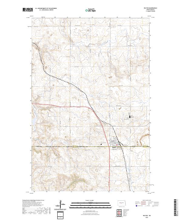
2024 Map of Wilton
USGS Topo · Published 2024About this map
Wilton anchors the southern portion of this landscape at the boundary of McLean and Burleigh counties. The town center shows a traditional grid of streets, including Bismarck Ave, Dakota Ave, and Minnesota Ave, indicating its importance as a regional crossroads. A concentration of religious and historical sites surrounds the community, notably the Holy Trinity Orthodox Cem, Sacred Heart Cem, and Saints Peter and Paul Cem, which reflect the heritage of early settlers in this part of North Dakota. The surrounding terrain is defined by the drainage of Burnt Creek and Painted Woods Creek, while the section lines are clearly delineated by a network of rural roads like 331st St and 14th St SW, illustrating the enduring influence of the Public Land Survey System on the modern prairie.
Find a feature on this map
34 named features on this map. Tap any name to fly to it.
Don’t see what you’re looking for? This feature index may not catch every label — zoom into the map to look around manually.
Map Details
Editions of this 2024 Wilton Map
This is the sole edition of this map. No revisions or reprints were ever made.
Other maps of this area

1949 · Turtle Creek
USGS Topo · 1:62,500

1950 · Wilton
USGS Topo · 1:62,500

1954 · McClusky
USGS Topo · 1:250,000

1958 · McClusky
USGS Topo · 1:250,000

1959 · Mercer SW
USGS Topo · 1:24,000

1961 · Turtle Creek SW
USGS Topo · 1:24,000

1961 · Turtle Creek SE
USGS Topo · 1:24,000

1966 · Price
USGS Topo · 1:24,000

1966 · Wilton SE
USGS Topo · 1:24,000
1966 · Sanger
USGS Topo · 1:24,000