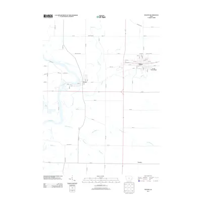
2013 Map of Wilton
USGS Topo · Published 2013About this map
Wilton serves as the primary municipal center in this section of Muscatine County, defined by its grid of residential streets like W 6th St and its proximity to South Towne Park. The landscape is deeply influenced by the winding course of the Cedar River to the west, which creates a complex hydrology of backwaters and wetland areas including Wiese Slough. Smaller communities like Moscow and the settlement of Sugar Creek Mills illustrate the historical importance of local watercourses such as Sugar Cr and Mud Cr in dictating the placement of early townships. The southern portion of the quadrangle transitions into more open agricultural land, where labels like Summit and the branching paths of Little Mosquito Cr and Mosquito Cr mark the rural reaches beyond the town centers.
Find a feature on this map
51 named features on this map. Tap any name to fly to it.
Don’t see what you’re looking for? This feature index may not catch every label — zoom into the map to look around manually.
Map Details
Editions of this 2013 Wilton Map
This is the sole edition of this map. No revisions or reprints were ever made.
Other maps of this area

1890 · Durant
USGS Topo · 1:62,500

1891 · Wilton Junction
USGS Topo · 1:62,500

1894 · Durant
USGS Topo · 1:62,500

1901 · Rock Island
USGS Topo · 1:125,000

1901 · Stanwood
USGS Topo · 1:125,000

1910 · Rock Island
USGS Topo · 1:125,000

1916 · Edgington
USGS Topo · 1:62,500

1938 · Edgington
USGS Topo · 1:62,500

1948 · Muscatine
USGS Topo · 1:62,500

1953 · Wilton Junction
USGS Topo · 1:24,000