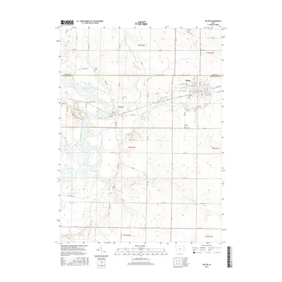
2015 Map of Wilton
USGS Topo · Published 2015About this map
Wilton and the smaller river-side settlement of Moscow define the geography of this Cedar and Muscatine County borderland. The area is characterized by a dense network of township roads and family burial grounds that reflect generations of agricultural settlement. The west is dominated by the winding course of the Cedar River, which creates a complex landscape of wetlands and oxbows, while Sugar Creek and Mud Cr drain the central and eastern uplands. Genealogists will find a high concentration of small rural cemeteries, such as Hebron Cem, Healey Cem, and Sharon Cem, often situated on high ground away from the floodplains. The street grid of Wilton is shown in detail, including its rail orientation along W Railroad St and the location of Oakdale Cem at the southern edge of the town center.
Find a feature on this map
55 named features on this map. Tap any name to fly to it.
Don’t see what you’re looking for? This feature index may not catch every label — zoom into the map to look around manually.
Map Details
Editions of this 2015 Wilton Map
This is the sole edition of this map. No revisions or reprints were ever made.
Other maps of this area

1890 · Durant
USGS Topo · 1:62,500

1891 · Wilton Junction
USGS Topo · 1:62,500

1894 · Durant
USGS Topo · 1:62,500

1901 · Rock Island
USGS Topo · 1:125,000

1901 · Stanwood
USGS Topo · 1:125,000

1910 · Rock Island
USGS Topo · 1:125,000

1916 · Edgington
USGS Topo · 1:62,500

1938 · Edgington
USGS Topo · 1:62,500

1948 · Muscatine
USGS Topo · 1:62,500

1953 · Wilton Junction
USGS Topo · 1:24,000