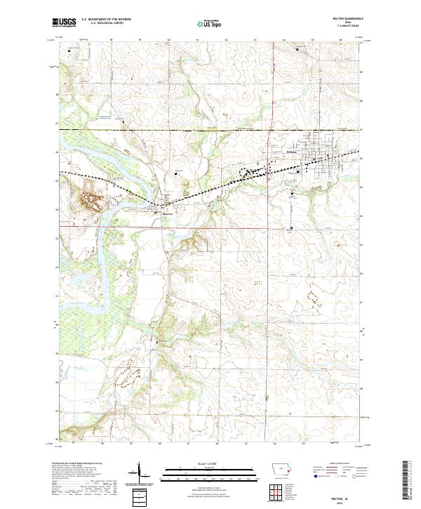
2022 Map of Wilton
USGS Topo · Published 2022About this map
The town of Wilton serves as the primary hub on this eastern Iowa landscape, situated at the intersection of several significant regional roads and waterways. The grid of the town is detailed with street-level precision, including W Rose St and Locust St, while the community of Moscow sits to the west along the banks of the Cedar River. This area is defined by the convergence of several drainages, including Sugar Creek, Mud Creek, and Otter Cr, which carve through the land between the Muscatine and Cedar County line.
Find a feature on this map
78 named features on this map. Tap any name to fly to it.
Don’t see what you’re looking for? This feature index may not catch every label — zoom into the map to look around manually.
Map Details
Editions of this 2022 Wilton Map
This is the sole edition of this map. No revisions or reprints were ever made.
Other maps of this area

1890 · Durant
USGS Topo · 1:62,500

1891 · Wilton Junction
USGS Topo · 1:62,500

1894 · Durant
USGS Topo · 1:62,500

1901 · Rock Island
USGS Topo · 1:125,000

1901 · Stanwood
USGS Topo · 1:125,000

1910 · Rock Island
USGS Topo · 1:125,000

1916 · Edgington
USGS Topo · 1:62,500

1938 · Edgington
USGS Topo · 1:62,500

1948 · Muscatine
USGS Topo · 1:62,500

1953 · Wilton Junction
USGS Topo · 1:24,000