
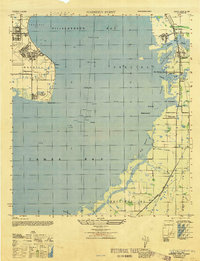
1944 Map of Wimauma
USGS Topo · Published 1944About this map
The settlement of Wimauma serves as the central hub of this 1944 survey, situated at the junction of the Seaboard Air Line railroad and the Wimauma Road. This era captures the town's local infrastructure before significant modern expansion, highlighting the Wimauma Airport and a prominent Tower near the residential grid. The landscape is defined by the winding course of the Little Manatee River to the south and the Tamiami Trail cutting across the western terrain, providing a look at the early highway network of Hillsborough County.
Find a feature on this map
19 named features on this map. Tap any name to fly to it.
Don’t see what you’re looking for? This feature index may not catch every label — zoom into the map to look around manually.
Map Details
Editions of this 1944 Wimauma Map
This is the sole edition of this map. No revisions or reprints were ever made.
Other maps of this area

1921 · Tampa
USGS Topo · 1:62,500

1944 · Ruskin
USGS Topo · 1:31,680

1944 · Rye
USGS Topo · 1:31,680

1944 · Parish
USGS Topo · 1:31,680

1944 · Balm
USGS Topo · 1:31,680

1945 · Gadsden Point
USGS Topo · 1:31,680

1947 · Ruskin
USGS Topo · 1:25,000

1947 · Wimauma
USGS Topo · 1:25,000
1947 · Gadsden Point
USGS Topo · 1:25,000

1955 · Lithia
USGS Topo · 1:24,000