
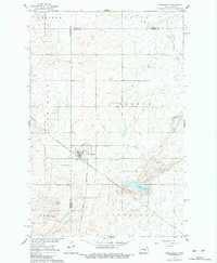
1961 Map of Wimbledon
USGS Topo · Published 1963About this map
Wimbledon sits at the junction of two distinct rail systems in the early 1960s, serving as a hub for the surrounding prairie townships. The Midland Continental and Soo Line railroads converge here, illustrating the town's historical importance as a transport node for the region's agricultural output. The landscape is defined by the glacial depressions of the Missouri River Basin, most notably the marshy expanse of Mud Lake to the southeast. Local history is anchored by St Boniface Cem and Prairie View Cem, which mark the community's early settlement foundations. Surrounding the town, the platting of Pierce and Uxbridge townships reveals a network of section lines and field boundaries established by the Geological Survey as part of the Missouri River Basin development program.
Find a feature on this map
18 named features on this map. Tap any name to fly to it.
Don’t see what you’re looking for? This feature index may not catch every label — zoom into the map to look around manually.
Map Details
Editions of this 1961 Wimbledon Map
2 editions found
Other maps of this area

1900 · Pingree
USGS Topo · 1:125,000

1951 · Spiritwood Lake
USGS Topo · 1:24,000

1951 · Courtenay
USGS Topo · 1:24,000

1951 · Kensal SE
USGS Topo · 1:24,000

1952 · New Rockford
USGS Topo · 1:250,000

1956 · New Rockford
USGS Topo · 1:250,000

1961 · Leal
USGS Topo · 1:24,000

1961 · Revere
USGS Topo · 1:24,000

1961 · Wimbledon NE
USGS Topo · 1:24,000
1961 · Sutton SW
USGS Topo · 1:24,000