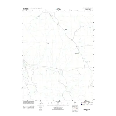
2011 Map of Win Wan Flat
USGS Topo · Published 2011About this map
Midway and Gillis Camp sit at the center of this 2011 survey, marking small points of human activity in an arid basin-and-range landscape of Nevada. The map is defined by its critical water sources, which are named and located with precision across the terrain. These include Wild Rose Spring, Whiskey Spring, Martinez Spring, and Dripping Vat Spring, several of which appear to support livestock or local land use.
Find a feature on this map
15 named features on this map. Tap any name to fly to it.
Don’t see what you’re looking for? This feature index may not catch every label — zoom into the map to look around manually.
Map Details
Editions of this 2011 Win Wan Flat Map
This is the sole edition of this map. No revisions or reprints were ever made.
Other maps of this area

1909 · Hawthorne
USGS Topo · 1:250,000

1911 · Hawthorne
USGS Topo · 1:250,000

1915 · Hawthorne
USGS Topo · 1:250,000

1948 · Walker Lake
USGS Topo · 1:250,000

1957 · Walker Lake
USGS Topo · 1:250,000

1962 · Walker Lake
USGS Topo · 1:250,000

1964 · Walker Lake
USGS Topo · 1:250,000
1979 · Copper Mtn.
USGS Topo · 1:24,000
1979 · Indian Head Peak
USGS Topo · 1:24,000
1979 · Ramsey Spring
USGS Topo · 1:24,000