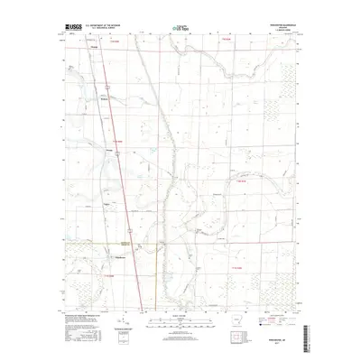
2017 Map of Winchester
USGS Topo · Published 2017About this map
Winchester and the surrounding agricultural bottomlands of the Arkansas Delta are defined by a complex network of bayous and drainage canals that manage the wet lowlands. This survey illustrates the proximity of the Desha Co and Drew Co line, where small communities like Yukon, Omega, and Pickens are scattered along the corridor of Old Hwy 65. The landscape is heavily marked by the region's hydrography, featuring the winding courses of Amos Bayou, Dry Bayou, and Wells Bayou alongside artificial improvements like Canal Number 19. For local historians and genealogists, the map is particularly useful for locating numerous small burial grounds, including Oak Grove Cem, Newton Cem, and Scott Cem, which serve as vital landmarks for the rural families of this cotton-producing region. The settlement pattern remains closely tied to these watercourses and the historic highway routes through the southern reaches of Dumas.
Find a feature on this map
65 named features on this map. Tap any name to fly to it.
Don’t see what you’re looking for? This feature index may not catch every label — zoom into the map to look around manually.
Map Details
Editions of this 2017 Winchester Map
This is the sole edition of this map. No revisions or reprints were ever made.
Other maps of this area

1935 · Cominto
USGS Topo · 1:62,500

1935 · Rotan
USGS Topo · 1:62,500

1935 · Red Fork
USGS Topo · 1:62,500

1936 · McGehee
USGS Topo · 1:62,500

1937 · McGehee
USGS Topo · 1:62,500

1953 · Greenwood
USGS Topo · 1:250,000

1955 · McGehee
USGS Topo · 1:62,500

1956 · Greenwood
USGS Topo · 1:250,000

1960 · Selma
USGS Topo · 1:24,000

1960 · Collins
USGS Topo · 1:62,500