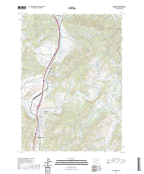
2023 Map of Winchester
USGS Topo · Published 2023About this map
The North Umpqua River carves a winding path through this Douglas County landscape, serving as a central geographic anchor between the communities of Sutherlin and Roseburg. The map illustrates a corridor of significant local development, featuring the campus of Umpqua Community College and the residential expansion of Roseburg North and Winchester. High points like Winchester Baldy and Richards Butte rise above the river valley, which is interconnected by a network of rural roads such as Deady Crossing Rd and N Bank Rd. Local history and genealogy interests are well-represented by the inclusion of the Otey Cem and Wilbur Cem, alongside smaller settlements like Wilbur. The presence of the Winchester Reservoir and numerous tributaries, including Sutherlin Creek and Dixon Creek, highlights the complex water systems that have influenced the region's settlement and utility.
Find a feature on this map
76 named features on this map. Tap any name to fly to it.
Don’t see what you’re looking for? This feature index may not catch every label — zoom into the map to look around manually.
Map Details
Editions of this 2023 Winchester Map
This is the sole edition of this map. No revisions or reprints were ever made.
Other maps of this area

1897 · Roseburg
USGS Topo · 1:125,000

1900 · Roseburg
USGS Topo · 1:125,000

1954 · Dixonville
USGS Topo · 1:62,500

1954 · Sutherlin
USGS Topo · 1:62,500

1954 · Glide
USGS Topo · 1:62,500

1955 · Roseburg
USGS Topo · 1:62,500

1958 · Roseburg
USGS Topo · 1:250,000

1959 · Roseburg
USGS Topo · 1:250,000

1979 · Roseburg
USGS Topo · 1:100,000
1987 · Roseburg East
USGS Topo · 1:24,000