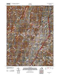
2010 Map of Winchester
USGS Topo · Published 2010About this map
Winchester and its suburban expansion define this landscape in the northern Shenandoah Valley. The map documents the city's complex network of historical sites and modern infrastructure, from the Winchester National Cemetery and Mount Hebron Cemetery in the urban core to the growing residential developments of Green Acres and Country Club Estates. To the west, the terrain rises toward Little North Mountain, where older agricultural patterns and family burial grounds like Yeakley Cemetery and Hodgson Cemetery persist alongside topographical features such as Apple Pie Ridge. In the south, the village of Kernstown remains a distinct point of interest near Shenandoah University. The area is bisected by numerous waterways including Abrams Creek and Opequon Creek, illustrating how the valley's drainage influenced the placement of original settlements like Nain and Albin.
Find a feature on this map
105 named features on this map. Tap any name to fly to it.
Don’t see what you’re looking for? This feature index may not catch every label — zoom into the map to look around manually.
Map Details
Editions of this 2010 Winchester Map
This is the sole edition of this map. No revisions or reprints were ever made.
Other maps of this area

1894 · Winchester
USGS Topo · 1:125,000

1914 · Gerrardstown
USGS Topo · 1:48,000

1916 · Gerrardstown
USGS Topo · 1:62,500

1916 · Capon Bridge
USGS Topo · 1:62,500

1923 · Middletown
USGS Topo · 1:62,500

1923 · Capon Bridge
USGS Topo · 1:62,500

1937 · Capon Bridge
USGS Topo · 1:48,000

1937 · Gerrardstown
USGS Topo · 1:48,000

1937 · Middletown
USGS Topo · 1:48,000

1938 · Winchester
USGS Topo · 1:48,000