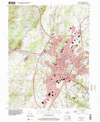
1997 Map of Winchester
USGS Topo · Published 2001About this map
Winchester stands as the primary urban center of this Frederick County landscape, where the intersection of major transit routes meets a landscape steeped in institutional and educational history. The city's core is defined by landmarks like the Courthouse, City Hall, and the historical Old Stone Church, while the surrounding geography is shaped by prominent ridges including North Mountain and the orchards of Apple Pie Ridge. Local genealogy is well-preserved through numerous burial grounds, such as the expansive Mt Hebron Cemetery and the more remote Old Opequon Church Cemetery near Kernstown. The map reveals a robust educational infrastructure, featuring schools like Handley High School and Shenandoah College. Military history is visible in the fortifications at Star Fort Winchester and Fort Milroy, while the western periphery transitions into the higher elevations of Hunting Ridge.
Find a feature on this map
63 named features on this map. Tap any name to fly to it.
Don’t see what you’re looking for? This feature index may not catch every label — zoom into the map to look around manually.
Map Details
Editions of this 1997 Winchester Map
This is the sole edition of this map. No revisions or reprints were ever made.
Other maps of this area

1894 · Winchester
USGS Topo · 1:125,000

1914 · Gerrardstown
USGS Topo · 1:48,000

1916 · Gerrardstown
USGS Topo · 1:62,500

1916 · Capon Bridge
USGS Topo · 1:62,500

1923 · Middletown
USGS Topo · 1:62,500

1923 · Capon Bridge
USGS Topo · 1:62,500

1937 · Capon Bridge
USGS Topo · 1:48,000

1937 · Gerrardstown
USGS Topo · 1:48,000

1937 · Middletown
USGS Topo · 1:48,000

1938 · Winchester
USGS Topo · 1:48,000