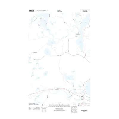
2013 Map of Winchester
USGS Topo · Published 2013About this map
The Turtle River and the Manitowish River define the intricate waterways of this northern Wisconsin landscape. Centered on the settlement of Winchester, the terrain is dominated by a dense concentration of glacial lakes, ranging from the large expanses of Fisher Lake and Twin Lakes to smaller, distinct bodies such as Circle Lily Lake and Lake Adelaide. The road network, including Co Hwy-W and Us-51, connects these water bodies to the community of Manitowish Waters in the south. Local landmarks like Agony Point Rd and W Rock Lake Rd provide specific geographical markers for those studying the residential and recreational development of Iron County. The map captures the area's transition into the 21st century, showing how infrastructure such as the Manitowish River Access Rd has been integrated into the natural lake-and-river system.
Find a feature on this map
74 named features on this map. Tap any name to fly to it.
Don’t see what you’re looking for? This feature index may not catch every label — zoom into the map to look around manually.
Map Details
Editions of this 2013 Winchester Map
This is the sole edition of this map. No revisions or reprints were ever made.
Other maps of this area

1939 · Winchester
USGS Topo · 1:48,000

1940 · Mercer
USGS Topo · 1:48,000

1943 · Ironwood
USGS Topo · 1:48,000

1945 · Mercer
USGS Topo · 1:48,000

1946 · Winchester
USGS Topo · 1:48,000

1947 · Mercer
USGS Topo · 1:48,000

1953 · Ashland
USGS Topo · 1:250,000

1955 · Mercer
USGS Topo · 1:62,500

1955 · Winchester
USGS Topo · 1:62,500

1955 · Wakefield
USGS Topo · 1:62,500