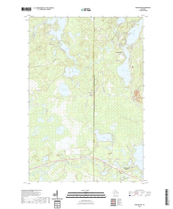
2022 Map of Winchester
USGS Topo · Published 2022About this map
Winchester and Manitowish Waters anchor this survey of the Northwoods at the boundary of Iron and Vilas counties. The landscape is defined by an intricate network of glacial lakes and river systems, including the Turtle River which winds through the northern section and the Manitowish River to the south. Historically significant transport routes are evident in the Railroad Grade running through the western wetlands and the naming of local landmarks such as Agony Point Rd and Fisher Lake Rd. The map details the dense distribution of water bodies like Fisher Lake, Cedar Lake, and Rest Lake, reflecting the region's importance as a premier recreational and timber destination. Subtle topographical variations and extensive wetland systems surround isolated settlements, showing the established footprint of modern shoreline development against the older rural infrastructure represented by numerous labeled forest roads and county highways.
Find a feature on this map
86 named features on this map. Tap any name to fly to it.
Don’t see what you’re looking for? This feature index may not catch every label — zoom into the map to look around manually.
Map Details
Editions of this 2022 Winchester Map
This is the sole edition of this map. No revisions or reprints were ever made.
Other maps of this area

1939 · Winchester
USGS Topo · 1:48,000

1940 · Mercer
USGS Topo · 1:48,000

1943 · Ironwood
USGS Topo · 1:48,000

1945 · Mercer
USGS Topo · 1:48,000

1946 · Winchester
USGS Topo · 1:48,000

1947 · Mercer
USGS Topo · 1:48,000

1953 · Ashland
USGS Topo · 1:250,000

1955 · Mercer
USGS Topo · 1:62,500

1955 · Winchester
USGS Topo · 1:62,500

1955 · Wakefield
USGS Topo · 1:62,500