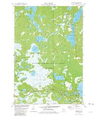
1981 Map of Winchester
USGS Topo · Published 1982About this map
The town of Winchester serves as the primary hub for this lake-strewn corner of northern Wisconsin, where the Turtle River winds between significant water bodies like North Turtle Lake and South Turtle Lake. The landscape is dominated by the Northern Highland-American Legion State Forest, reflecting a region dedicated to conservation and seasonal recreation during the late 1970s.
Find a feature on this map
51 named features on this map. Tap any name to fly to it.
Don’t see what you’re looking for? This feature index may not catch every label — zoom into the map to look around manually.
Map Details
Editions of this 1981 Winchester Map
This is the sole edition of this map. No revisions or reprints were ever made.
Other maps of this area

1939 · Winchester
USGS Topo · 1:48,000

1940 · Mercer
USGS Topo · 1:48,000

1943 · Ironwood
USGS Topo · 1:48,000

1945 · Mercer
USGS Topo · 1:48,000

1946 · Winchester
USGS Topo · 1:48,000

1947 · Mercer
USGS Topo · 1:48,000

1953 · Ashland
USGS Topo · 1:250,000

1955 · Mercer
USGS Topo · 1:62,500

1955 · Winchester
USGS Topo · 1:62,500

1955 · Wakefield
USGS Topo · 1:62,500