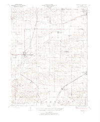
1924 Map of Winchester
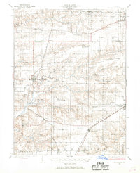
USGS Topo · Published 1969About this map
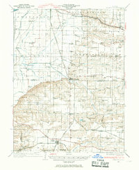
Winchester and Jacksonville anchor this 1920s landscape at the intersection of early state highways and multiple rail lines. The Chicago Burlington and Quincy RR and the Chicago and Alton RR cut through the undulating terrain, connecting agricultural hubs like Alsey, Manchester, and Murrayville. The sheer density of local education is striking, with dozens of family-named rural schools including Strawns Grove School, Victory School, and Tin Oak School dotting the countryside every few miles, representing the zenith of the one-room schoolhouse era before mid-century consolidation. Along the western edge near Exeter, the topography drops toward the drainage of Plum Creek, while landmarks like the Poor Farm south of the county seat provide a glimpse into the social infrastructure of the time. This survey captures a moment when the rural population was dispersed across nearly every section of land, supported by a network of creeks like Mauvaise Terre Creek and Big Sandy Creek.
Find a feature on this map
65 named features on this map. Tap any name to fly to it.
Don’t see what you’re looking for? This feature index may not catch every label — zoom into the map to look around manually.
Map Details
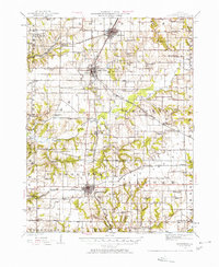
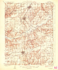
Editions of this 1924 Winchester Map
3 editions found
Other maps of this area

1924 · Winchester
USGS Topo · 1:48,000
1924 · Roodhouse
USGS Topo · 1:62,500

1924 · Griggsville
USGS Topo · 1:62,500

1926 · Griggsville
USGS Topo · 1:62,500

1926 · Winchester
USGS Topo · 1:62,500
1926 · Roodhouse
USGS Topo · 1:62,500

1928 · Meredosia
USGS Topo · 1:62,500
1929 · Arenzville
USGS Topo · 1:62,500

1930 · Pearl
USGS Topo · 1:62,500

1931 · Meredosia
USGS Topo · 1:62,500