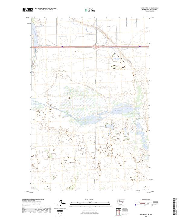
2023 Map of Winchester SE
USGS Topo · Published 2023About this map
Winchester Wasteway defines this landscape in Grant County, functioning as a critical component of the regional irrigation and drainage system. This hydraulic feature cuts diagonally across the terrain, creating a complex of wetlands and seasonal water bodies that stand in contrast to the surrounding agricultural grid. The map reveals a highly structured landscape organized by the Public Land Survey System, with townships such as t18n r26e and t19n r26e clearly delineated. Human infrastructure is dominated by the east-west corridor of the interstate system, bordered by N Frontage Rd W and S Frontage Rd W. The secondary road network, including Dodson Rd N and Rd 2 NW, follows rigid section lines, illustrating the intersection of large-scale water management and modern transportation in the high desert.
Find a feature on this map
22 named features on this map. Tap any name to fly to it.
Don’t see what you’re looking for? This feature index may not catch every label — zoom into the map to look around manually.
Map Details
Editions of this 2023 Winchester SE Map
This is the sole edition of this map. No revisions or reprints were ever made.
Other maps of this area

1910 · Winchester
USGS Topo · 1:62,500

1911 · Red Rock
USGS Topo · 1:62,500

1912 · Moses Lake
USGS Topo · 1:62,500

1923 · Corfu
USGS Topo · 1:62,500

1950 · Smyrna
USGS Topo · 1:62,500

1951 · Smyrna
USGS Topo · 1:62,500

1951 · Corfu
USGS Topo · 1:62,500

1953 · Walla Walla
USGS Topo · 1:250,000

1953 · Ritzville
USGS Topo · 1:250,000

1956 · Mae
USGS Topo · 1:24,000