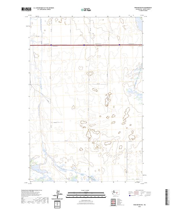
2023 Map of Winchester SW
USGS Topo · Published 2023About this map
Frenchman Hills Wasteway and Winchester Wasteway define this landscape within the t18n r25e and t19n r25e townships of Grant County. This modern survey illustrates the critical irrigation and drainage infrastructure supporting Washington's Columbia Basin. The network of frontage roads, including N Frontage Rd W and S Frontage Rd W, parallels the major east-west transportation corridor, while a grid of local routes like Ditch Rd and RD K SW provides access to the surrounding agricultural sections. The presence of these wasteways indicates a highly managed hydraulic environment where surplus irrigation water is channeled through the basin. Local researchers can trace the precise intersections of township lines and county roads that organize this rural landscape.
Find a feature on this map
23 named features on this map. Tap any name to fly to it.
Don’t see what you’re looking for? This feature index may not catch every label — zoom into the map to look around manually.
Map Details
Editions of this 2023 Winchester SW Map
This is the sole edition of this map. No revisions or reprints were ever made.
Other maps of this area

1909 · Quincy
USGS Topo · 1:62,500

1910 · Quincy
USGS Topo · 1:62,500

1910 · Winchester
USGS Topo · 1:62,500

1911 · Red Rock
USGS Topo · 1:62,500

1912 · Beverly
USGS Topo · 1:62,500

1950 · Smyrna
USGS Topo · 1:62,500

1951 · Smyrna
USGS Topo · 1:62,500

1953 · Walla Walla
USGS Topo · 1:250,000

1953 · Ritzville
USGS Topo · 1:250,000

1954 · Beverly NE
USGS Topo · 1:24,000