
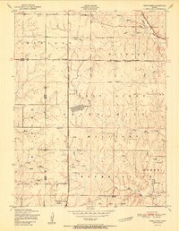
1951 Map of Wind Creek
USGS Topo · Published 1951About this map
The Fort Riley Military Reservation dominates the eastern half of this landscape, its boundary cutting across the terrain north of Vinton Baptist Church. Surveyed in the late 1940s, the map reveals a military training environment interspersed with rural community landmarks. Evidence of active use is seen at the vehicle firing range and moving target areas, while numerous notations of Ruins suggest the displacement of earlier homesteads as the reservation expanded.
Find a feature on this map
27 named features on this map. Tap any name to fly to it.
Don’t see what you’re looking for? This feature index may not catch every label — zoom into the map to look around manually.
Map Details
Editions of this 1951 Wind Creek Map
2 editions found
Other maps of this area

1886 · Junction City
USGS Topo · 1:125,000

1889 · Junction City
USGS Topo · 1:125,000

1894 · Junction City
USGS Topo · 1:125,000

1947 · Manhattan
USGS Topo · 1:62,500

1947 · Fort Riley
USGS Topo · 1:62,500

1950 · Keats
USGS Topo · 1:24,000

1950 · Junction City
USGS Topo · 1:24,000

1950 · Alida
USGS Topo · 1:24,000

1951 · Ogden
USGS Topo · 1:24,000

1951 · Milford
USGS Topo · 1:24,000