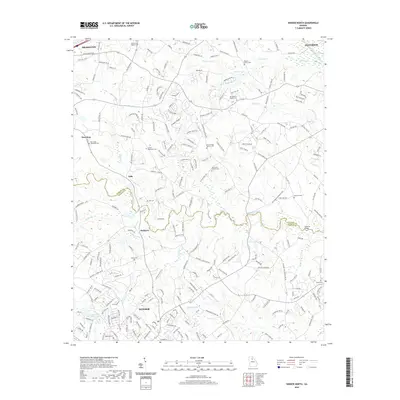
2020 Map of Winder North
USGS Topo · Published 2020About this map
The Mulberry River winds across the Piedmont landscape of Northeast Georgia, serving as the natural boundary between Jackson and Barrow counties. This contemporary topographic survey documents the expanding suburban interface between the city of Winder and the growing communities of Braselton and Hoschton. The settlement pattern reflects a deep agricultural heritage, preserved in a network of historic burial grounds and rural congregations such as the White Plains Baptist Cem and New Hope Methodist Cem. While modern developments like Mulberry Greens Ln and Traditions Way indicate recent growth, the map retains essential landmarks for local historians and genealogists. From the northern reach of the Middle Oconee River near Jefferson to the southern Winder Reservoir, the terrain is marked by numerous family-named sites, including Lyle Cem and House Cem, and the crossing at Hancock Bridge.
Find a feature on this map
229 named features on this map. Tap any name to fly to it.
Don’t see what you’re looking for? This feature index may not catch every label — zoom into the map to look around manually.
Map Details
Editions of this 2020 Winder North Map
This is the sole edition of this map. No revisions or reprints were ever made.
Other maps of this area

1891 · Gainesville
USGS Topo · 1:125,000

1896 · Monroe
USGS Topo · 1:125,000

1953 · Athens
USGS Topo · 1:250,000

1954 · Greenville
USGS Topo · 1:250,000

1958 · Greenville
USGS Topo · 1:250,000

1958 · Athens
USGS Topo · 1:250,000

1959 · Athens
USGS Topo · 1:250,000

1963 · Athens
USGS Topo · 1:250,000

1964 · Chestnut Mountain
USGS Topo · 1:24,000

1964 · Bold Springs
USGS Topo · 1:24,000