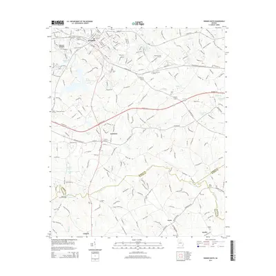
2014 Map of Winder South
USGS Topo · Published 2014About this map
Winder serves as the focal point of this North Georgia survey, where the convergence of several major routes, including Ga-211 and Ga-82, centers on the town's urban core. The landscape transitions from the developed streets of Barrow Heights and Bethlehem toward the pastoral reaches of Gratis and Campton in the south. This era shows the developed suburban character of the region, anchored by the Barrow County Airport and the commercial corridor along Ga-8 and Ga-11.
Find a feature on this map
228 named features on this map. Tap any name to fly to it.
Don’t see what you’re looking for? This feature index may not catch every label — zoom into the map to look around manually.
Map Details
Editions of this 2014 Winder South Map
This is the sole edition of this map. No revisions or reprints were ever made.
Other maps of this area

1891 · Gainesville
USGS Topo · 1:125,000

1896 · Monroe
USGS Topo · 1:125,000

1953 · Athens
USGS Topo · 1:250,000

1954 · Greenville
USGS Topo · 1:250,000

1958 · Greenville
USGS Topo · 1:250,000

1958 · Athens
USGS Topo · 1:250,000

1959 · Athens
USGS Topo · 1:250,000

1963 · Athens
USGS Topo · 1:250,000

1964 · Bold Springs
USGS Topo · 1:24,000

1964 · Between
USGS Topo · 1:24,000