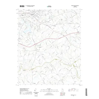
2020 Map of Winder South
USGS Topo · Published 2020About this map
The southern outskirts of Winder and the rural lands of Barrow County are captured here as the suburban landscape transitions into the rolling hills of the Georgia Piedmont. This area, just south of the city center, is defined by the winding course of the Apalachee River, which serves as a natural boundary near Apalachee Falls. The map reveals a dense network of local cemeteries and community landmarks, such as Rose Hill Cem, Smith Cem, and the notable Kilgore Mill Covered Bridge over Apalachee River. To the west, the landscape includes Masseys Lake and the residential expansion of Barrow Heights. Transportation is a major feature of the region, with the Barrow County Airport and the heavy corridors of University Pkwy and Atlanta Hwy SE facilitating the movement of people between smaller settlements like Bethlehem, Russell, and Gratis.
Find a feature on this map
221 named features on this map. Tap any name to fly to it.
Don’t see what you’re looking for? This feature index may not catch every label — zoom into the map to look around manually.
Map Details
Editions of this 2020 Winder South Map
This is the sole edition of this map. No revisions or reprints were ever made.
Other maps of this area

1891 · Gainesville
USGS Topo · 1:125,000

1896 · Monroe
USGS Topo · 1:125,000

1953 · Athens
USGS Topo · 1:250,000

1954 · Greenville
USGS Topo · 1:250,000

1958 · Greenville
USGS Topo · 1:250,000

1958 · Athens
USGS Topo · 1:250,000

1959 · Athens
USGS Topo · 1:250,000

1963 · Athens
USGS Topo · 1:250,000

1964 · Bold Springs
USGS Topo · 1:24,000

1964 · Between
USGS Topo · 1:24,000