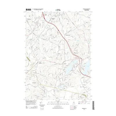
2015 Map of Windham
USGS Topo · Published 2015About this map
Windham and its surrounding communities in Rockingham County are defined by a complex network of glacial ponds and winding brooks. This 2015 survey illustrates how modern infrastructure, such as I-93 and the Londonderry Tpke, bisects a landscape traditionally shaped by water and local landmarks. To the north, West Derry and the crossroads at Peppermint Corner sit near the Londonderry Sewage Lagoon, while further south, the residential character deepens around substantial water bodies like Cobbetts Pond and the western edge of Canobie Lake. Local history is preserved in numerous burial grounds, including the Cem on the Plains and Cem on the Hill. The topography is punctuated by distinct granite features such as Butterfield Rock and Indian Rock, offering a detailed view of the terrain that has guided settlement patterns from Windham Depot to the edge of North Pelham.
Find a feature on this map
42 named features on this map. Tap any name to fly to it.
Don’t see what you’re looking for? This feature index may not catch every label — zoom into the map to look around manually.
Map Details
Editions of this 2015 Windham Map
This is the sole edition of this map. No revisions or reprints were ever made.
Other maps of this area

1886 · Lawrence
USGS Topo · 1:62,500

1886 · Lowell
USGS Topo · 1:62,500

1888 · Haverhill
USGS Topo · 1:62,500

1888 · Lawrence
USGS Topo · 1:62,500

1890 · Haverhill
USGS Topo · 1:62,500

1893 · Lowell
USGS Topo · 1:62,500

1893 · Lawrence
USGS Topo · 1:62,500

1893 · Haverhill
USGS Topo · 1:62,500

1905 · Manchester
USGS Topo · 1:62,500

1918 · Lowell
USGS Topo · 1:62,500