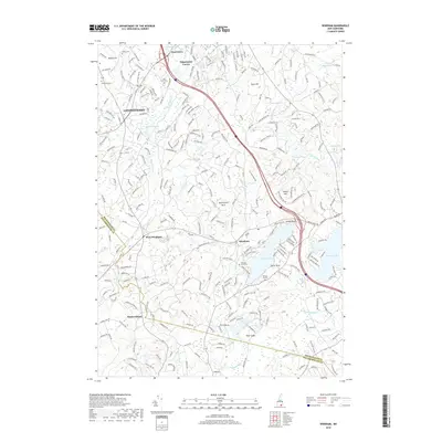
2018 Map of Windham
USGS Topo · Published 2018About this map
Londonderry and Windham anchor this landscape of the Rockingham and Hillsborough county borderlands, where suburban development intermingles with glacial terrain and historic burying grounds. Local heritage is preserved at sites like Valley Cem, Glenwood Cem, and the Cem on the Hill, while the distinct settlements of Peppermint Corner and West Windham mark longstanding community hubs. The area is defined by its significant water bodies, including the expansive Cobbetts Pond, the shores of Canobie Lake, and the winding path of Beaver Brook. Topographical landmarks such as Butterfield Rock, Jennys Hill, and Turtle Rock punctuate the wooded hillsides. The Interstate 93 corridor and routes like NH 111 and NH 128 illustrate the modern transportation network that has shaped the growth of these New Hampshire towns while connecting them to the larger New England region.
Find a feature on this map
38 named features on this map. Tap any name to fly to it.
Don’t see what you’re looking for? This feature index may not catch every label — zoom into the map to look around manually.
Map Details
Editions of this 2018 Windham Map
This is the sole edition of this map. No revisions or reprints were ever made.
Other maps of this area

1886 · Lawrence
USGS Topo · 1:62,500

1886 · Lowell
USGS Topo · 1:62,500

1888 · Haverhill
USGS Topo · 1:62,500

1888 · Lawrence
USGS Topo · 1:62,500

1890 · Haverhill
USGS Topo · 1:62,500

1893 · Lowell
USGS Topo · 1:62,500

1893 · Lawrence
USGS Topo · 1:62,500

1893 · Haverhill
USGS Topo · 1:62,500

1905 · Manchester
USGS Topo · 1:62,500

1918 · Lowell
USGS Topo · 1:62,500