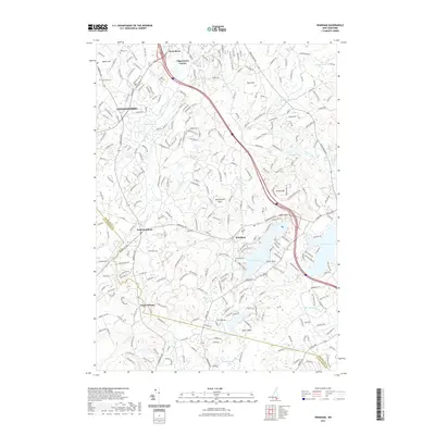
2021 Map of Windham
USGS Topo · Published 2021About this map
Cobbetts Pond and the larger Canobie Lake define the water-rich landscape of Rockingham County as it appears in this 2021 study. The terrain is marked by distinctive granite features like Butterfield Rock and Turtle Rock, while the human geography is anchored by the historic village of Windham. Settlement patterns range from the suburban expansion in Londonderry and West Derry to the smaller intersections of Peppermint Corner and North Pelham. Genealogists will find several burial grounds across the area, including the Old Plains Cem and the Cem On The Hill, alongside larger sites like Holy Cross Cem. The drainage network of Beaver Brook and Golden Brook snakes through the hills, illustrating the natural boundaries that shaped local development from early colonial times through the modern era.
Find a feature on this map
272 named features on this map. Tap any name to fly to it.
Don’t see what you’re looking for? This feature index may not catch every label — zoom into the map to look around manually.
Map Details
Editions of this 2021 Windham Map
This is the sole edition of this map. No revisions or reprints were ever made.
Other maps of this area

1886 · Lawrence
USGS Topo · 1:62,500

1886 · Lowell
USGS Topo · 1:62,500

1888 · Haverhill
USGS Topo · 1:62,500

1888 · Lawrence
USGS Topo · 1:62,500

1890 · Haverhill
USGS Topo · 1:62,500

1893 · Lowell
USGS Topo · 1:62,500

1893 · Lawrence
USGS Topo · 1:62,500

1893 · Haverhill
USGS Topo · 1:62,500

1905 · Manchester
USGS Topo · 1:62,500

1918 · Lowell
USGS Topo · 1:62,500