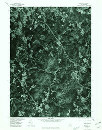
1977 Map of Windham
USGS Topo · Published 1981About this map
Windham and the surrounding Rockingham County landscape are captured in this orthophotograph, which uses aerial imagery taken in 1977 by the Soil Conservation Service. The visual record highlights the residential growth and transportation corridors shaping southern New Hampshire during the late 1970s. Significant water bodies dominate the eastern and southern portions of the quadrangle, including the large expanse of Cobbetts Pond and the shores of Canobie Lake. These lakes, along with smaller features like Rock Pond and Simpson Pond, represent the primary recreational and geographic anchors for the local communities. The settlement patterns of Londonderry and West Derry appear at the northern margins, while West Windham sits to the west. This map provides a unique view of the land before further suburban expansion, preserved through the photographic surveying methods of the era.
Find a feature on this map
9 named features on this map. Tap any name to fly to it.
Don’t see what you’re looking for? This feature index may not catch every label — zoom into the map to look around manually.
Map Details
Editions of this 1977 Windham Map
This is the sole edition of this map. No revisions or reprints were ever made.
Other maps of this area

1886 · Lawrence
USGS Topo · 1:62,500

1886 · Lowell
USGS Topo · 1:62,500

1888 · Haverhill
USGS Topo · 1:62,500

1888 · Lawrence
USGS Topo · 1:62,500

1890 · Haverhill
USGS Topo · 1:62,500

1893 · Lowell
USGS Topo · 1:62,500

1893 · Lawrence
USGS Topo · 1:62,500

1893 · Haverhill
USGS Topo · 1:62,500

1905 · Manchester
USGS Topo · 1:62,500

1918 · Lowell
USGS Topo · 1:62,500