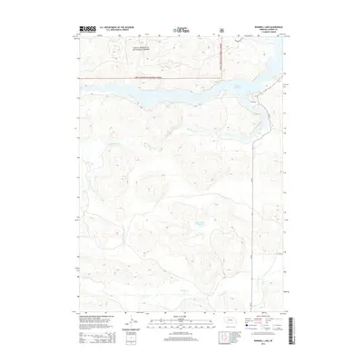
2014 Map of Windmill Lake
USGS Topo · Published 2014About this map
Sam R. McKelvie National Forest dominates the northern reaches of this landscape in the Nebraska Sandhills, where the terrain is defined by a dense network of water features. The map details the expansive Merritt Reservoir and its adjoining Cedar Bay, a significant water resource in this arid region. Moving south through the undulating topography, the drainage patterns of Boardman Cr and Gordon Cr reveal the natural hydrology of Cherry County. Remote access throughout the area is facilitated by local routes such as Ne-97 and specialized paths like the Powder Finger Trl. This survey captures the specialized land use of the early 21st century, balancing federal forest preservation with the management of isolated water bodies like the namesake Windmill Lake.
Find a feature on this map
10 named features on this map. Tap any name to fly to it.
Don’t see what you’re looking for? This feature index may not catch every label — zoom into the map to look around manually.
Map Details
Editions of this 2014 Windmill Lake Map
This is the sole edition of this map. No revisions or reprints were ever made.
Other maps of this area

1949 · Big Falls
USGS Topo · 1:62,500

1950 · Powderhorn Valley
USGS Topo · 1:62,500

1950 · Kennedy
USGS Topo · 1:62,500

1951 · Big Falls
USGS Topo · 1:62,500

1951 · Bull Lake
USGS Topo · 1:62,500

1957 · Valentine
USGS Topo · 1:250,000

1959 · Valentine
USGS Topo · 1:250,000

1985 · Mullen
USGS Topo · 1:100,000

1985 · Goose Creek
USGS Topo · 1:100,000

1985 · Cody
USGS Topo · 1:100,000