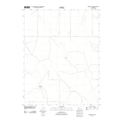
2010 Map of Windmill Lake
USGS Topo · Published 2010About this map
Lone Tree Creek and Breckenridge Creek dominate the drainage of this Crowley County landscape, illustrating the critical role of water management in eastern Colorado. The central landmark, Windmill Lake, alongside the George Lewis Number 5 Dam, points to a history of ranching and agricultural development where surface water is carefully captured. A strictly organized grid of rural corridors, including County Road AA and County RD W, defines the movement across the territory. The presence of several county line markers, from County Line 12 to County Line 17, suggests a region defined by precise administrative boundaries and large-scale land divisions common to the High Plains.
Find a feature on this map
16 named features on this map. Tap any name to fly to it.
Don’t see what you’re looking for? This feature index may not catch every label — zoom into the map to look around manually.
Map Details
Editions of this 2010 Windmill Lake Map
This is the sole edition of this map. No revisions or reprints were ever made.
Other maps of this area

1889 · Sanborn
USGS Topo · 1:125,000

1891 · Sanborn
USGS Topo · 1:125,000

1891 · Catlin
USGS Topo · 1:125,000

1893 · Sanborn
USGS Topo · 1:125,000

1893 · Catlin
USGS Topo · 1:125,000

1954 · Lamar
USGS Topo · 1:250,000

1958 · Lamar
USGS Topo · 1:250,000

1977 · Walker Point
USGS Topo · 1:24,000
1977 · Antelope Mesa
USGS Topo · 1:24,000
1977 · Box Springs
USGS Topo · 1:24,000