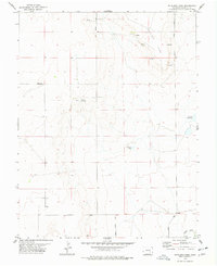
1977 Map of Antelope Mesa
USGS Topo · Published 1978About this map
Antelope Mesa rises above the high plains of Crowley County, defining the arid landscape of this 1970s survey. This territory is marked by the vital infrastructure of water management in a dry climate, ranging from natural features like Bluff Springs and numerous unnamed Springs to man-made developments like Cudahy Reservoir and Tennessee Pond. The southern edge of the sheet shows the Colorado Canal, a significant piece of irrigation engineering for the region. Transportation and local access are centered around Olney Springs Road and Cudahy Road, which connect the scattered points of interest. Though largely open range, the map notes the small settlement of Boney, providing a specific point of reference for genealogists tracking family history in this corner of the state during the mid-to-late twentieth century.
Find a feature on this map
11 named features on this map. Tap any name to fly to it.
Don’t see what you’re looking for? This feature index may not catch every label — zoom into the map to look around manually.
Map Details
Editions of this 1977 Antelope Mesa Map
This is the sole edition of this map. No revisions or reprints were ever made.
Other maps of this area

1891 · Catlin
USGS Topo · 1:125,000

1891 · Nepesta
USGS Topo · 1:125,000

1893 · Nepesta
USGS Topo · 1:125,000

1893 · Catlin
USGS Topo · 1:125,000

1904 · Nepesta
USGS Topo · 1:125,000

1954 · Olney Springs
USGS Topo · 1:24,000

1954 · Ordway
USGS Topo · 1:24,000

1954 · Lamar
USGS Topo · 1:250,000

1954 · Pueblo
USGS Topo · 1:250,000

1957 · Pueblo
USGS Topo · 1:250,000