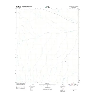
2011 Map of Window Mountain
USGS Topo · Published 2011About this map
Gu Achi Wash and Anegam Wash define the drainage patterns of this arid landscape in the early twenty-first century, carving seasonal paths through the desert floor. The terrain is anchored by the prominent Window Mountain and its namesake feature, The Window, which provide significant vertical relief in the northwestern portion of the map. Small settlements like Oit Ihuk and Noipa Kam are situated along these natural corridors, reflecting the sparse but enduring human presence in the region. The map reveals how modern infrastructure, specifically Indian Rte 34, follows the natural contours of the land to connect these remote locales. To the east, the Noipa Kam Hills and the winding Santa Rosa Wash further illustrate the geomorphology of the Sif Oidak District, where water and stone dictate the layout of community and transit.
Find a feature on this map
9 named features on this map. Tap any name to fly to it.
Don’t see what you’re looking for? This feature index may not catch every label — zoom into the map to look around manually.
Map Details
Editions of this 2011 Window Mountain Map
This is the sole edition of this map. No revisions or reprints were ever made.
Other maps of this area

1953 · Ajo
USGS Topo · 1:250,000

1957 · Ajo
USGS Topo · 1:250,000

1958 · Ajo
USGS Topo · 1:250,000

1962 · Ajo
USGS Topo · 1:250,000

1963 · Ajo
USGS Topo · 1:250,000

1963 · Gu Achi
USGS Topo · 1:62,500

1963 · Quijotoa Mts
USGS Topo · 1:62,500

1963 · Cimarron Peak
USGS Topo · 1:62,500

1963 · Pisinimo
USGS Topo · 1:62,500

1967 · Ajo
USGS Topo · 1:250,000