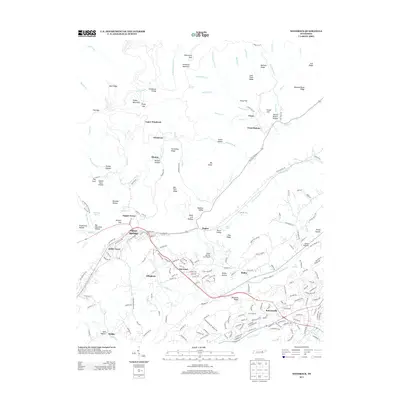
2013 Map of Windrock
USGS Topo · Published 2013About this map
Oliver Springs serves as the primary hub in this detailed look at the mountains and valleys north of Oak Ridge. The landscape is defined by the steep slopes of Windrock Mountain and Big Fork Ridge, which hem in narrow hollows such as Gibson Rock Hollow and Shoat Lick Hollow. This 2013 survey illustrates the dense residential development in Robertsville and Norwood, contrasting with the more dispersed, terrain-dictated settlements of Frost Bottom and Upper Windrock. The road network follows the natural contours, with Railroad Ave and Kingston Ave marking the town's core. Of particular interest is the Oliver Springs Inc Airport and the surrounding valley floor near Poplar Creek. This map records the modern footprint of community centers like Tupper Town and Kelley Town as they sit at the base of the Cumberland Plateau's eastern edge.
Find a feature on this map
224 named features on this map. Tap any name to fly to it.
Don’t see what you’re looking for? This feature index may not catch every label — zoom into the map to look around manually.
Map Details
Editions of this 2013 Windrock Map
This is the sole edition of this map. No revisions or reprints were ever made.
Other maps of this area

1893 · Briceville
USGS Topo · 1:125,000

1895 · Loudon
USGS Topo · 1:125,000

1895 · Briceville
USGS Topo · 1:125,000

1896 · Briceville
USGS Topo · 1:125,000

1935 · Elverton
USGS Topo · 1:24,000

1935 · Bethel Valley
USGS Topo · 1:24,000

1935 · Lovell
USGS Topo · 1:24,000

1936 · Hogbell Gap
USGS Topo · 1:24,000

1936 · Duncan Flats
USGS Topo · 1:24,000

1936 · Windrock
USGS Topo · 1:24,000