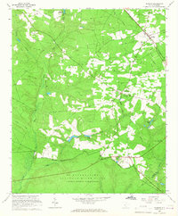
1965 Map of Windsor
USGS Topo · Published 1967About this map
Windsor and the sprawling Savannah River Plant dominate this mid-1960s landscape along the border of Aiken and Barnwell counties. The northern half of the map retains its rural character, anchored by small settlements like Rosemary and Mt Beulah, where local congregations gathered at Rosemary Ch and Beulah Grove Ch. The influence of the Southern railroad line is evident, providing a transport corridor through Windsor toward the coast.
Find a feature on this map
26 named features on this map. Tap any name to fly to it.
Don’t see what you’re looking for? This feature index may not catch every label — zoom into the map to look around manually.
Map Details
Editions of this 1965 Windsor Map
2 editions found
Other maps of this area

1920 · Aiken
USGS Topo · 1:48,000

1920 · Talatha
USGS Topo · 1:48,000

1921 · Aiken
USGS Topo · 1:62,500

1921 · Talatha
USGS Topo · 1:62,500

1923 · Williston
USGS Topo · 1:48,000

1927 · Williston
USGS Topo · 1:62,500

1943 · Aiken
USGS Topo · 1:62,500

1943 · Augusta East
USGS Topo · 1:125,000

1943 · Williston
USGS Topo · 1:62,500

1943 · Talatha
USGS Topo · 1:62,500