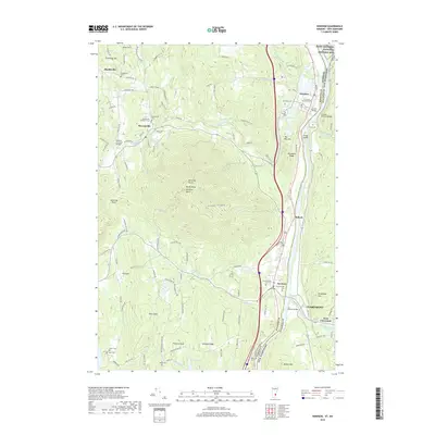
2018 Map of Windsor
USGS Topo · Published 2018About this map
The Connecticut River serves as the dividing line between Vermont and New Hampshire on this detailed survey, anchored by the town of Windsor and the expansive heights of the Monadnock-style Mt Ascutney North. The landscape is a mix of agricultural river valleys and steep wooded ridges, featuring notable historic preservation at the Saint-Gaudens National Historic Site and the famous Cornish-Windsor Bridge.
Find a feature on this map
120 named features on this map. Tap any name to fly to it.
Don’t see what you’re looking for? This feature index may not catch every label — zoom into the map to look around manually.
Map Details
Editions of this 2018 Windsor Map
This is the sole edition of this map. No revisions or reprints were ever made.
Other maps of this area

1906 · Hanover
USGS Topo · 1:62,500

1908 · Hanover
USGS Topo · 1:62,500

1911 · Woodstock
USGS Topo · 1:62,500

1913 · Woodstock
USGS Topo · 1:62,500

1926 · Claremont
USGS Topo · 1:62,500

1928 · Ludlow
USGS Topo · 1:48,000

1929 · Claremont
USGS Topo · 1:62,500

1929 · Ludlow
USGS Topo · 1:62,500

1932 · Ludlow
USGS Topo · 1:62,500

1943 · Woodstock
USGS Topo · 1:62,500