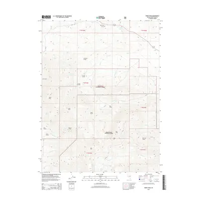
2015 Map of Windy Peak
USGS Topo · Published 2015About this map
Great Basin National Park and the Humboldt National Forest dominate this high-elevation landscape within the Snake Range. The topography is defined by dramatic elevation changes, rising from deep drainages like Lucky Boy Canyon and McGraff Canyon toward the summit of Windy Peak. High alpine water sources including Stella Lake, Teresa Lake, and Brown Lake cluster in the southern portion of the sheet, feeding the headwaters of Lehman Cr. This 2015 survey illustrates the primitive road network required to navigate the area, including Osceola Rd and NF-456. The map captures a transition from the lower Windy Canyon to the rugged interior peaks, reflecting a wilderness protected for its natural features and complex geology.
Find a feature on this map
45 named features on this map. Tap any name to fly to it.
Don’t see what you’re looking for? This feature index may not catch every label — zoom into the map to look around manually.
Map Details
Editions of this 2015 Windy Peak Map
This is the sole edition of this map. No revisions or reprints were ever made.
Other maps of this area

1948 · Wheeler Peak
USGS Topo · 1:62,500

1949 · Garrison
USGS Topo · 1:62,500

1950 · Wheeler Peak
USGS Topo · 1:62,500

1951 · Garrison
USGS Topo · 1:62,500

1956 · Lund
USGS Topo · 1:250,000

1956 · Ely
USGS Topo · 1:250,000

1959 · Ely
USGS Topo · 1:250,000

1959 · Sacramento Pass
USGS Topo · 1:62,500

1960 · Lund
USGS Topo · 1:250,000

1963 · Ely
USGS Topo · 1:250,000