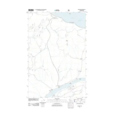
2011 Map of Winesap
USGS Topo · Published 2011About this map
The Columbia River winds through the southern portion of this landscape, carving a deep path between Winesap and the mouth of Navarre Coulee. This 2011 survey captures a region defined by its dramatic elevation changes and significant water bodies, with Lake Chelan bordering the northern reaches at Sunnybank. The map illustrates a complex network of canyons and gulches, such as Oklahoma Gulch and Ficher Canyon, which funnel toward the river.
Find a feature on this map
41 named features on this map. Tap any name to fly to it.
Don’t see what you’re looking for? This feature index may not catch every label — zoom into the map to look around manually.
Map Details
Editions of this 2011 Winesap Map
This is the sole edition of this map. No revisions or reprints were ever made.
Other maps of this area

1901 · Chelan
USGS Topo · 1:125,000

1957 · Wenatchee
USGS Topo · 1:250,000

1968 · Chelan
USGS Topo · 1:24,000

1968 · Waterville
USGS Topo · 1:24,000
1968 · Cooper Ridge
USGS Topo · 1:24,000

1968 · Entiat
USGS Topo · 1:24,000
1968 · Stormy Mtn.
USGS Topo · 1:24,000

1968 · Ardenvoir
USGS Topo · 1:24,000

1968 · Baldy Mtn
USGS Topo · 1:24,000

1968 · Winesap
USGS Topo · 1:24,000