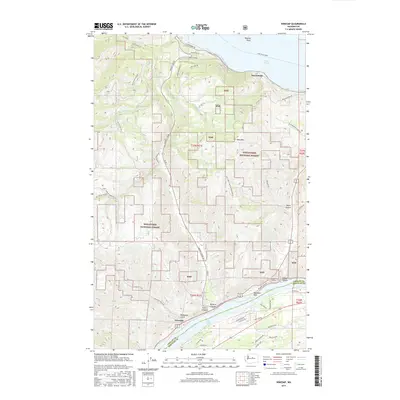
2017 Map of Winesap
USGS Topo · Published 2017About this map
Winesap and the surrounding agricultural and forest lands occupy a dramatic corner of the Pacific Northwest where the Columbia River forms Lake Entiat at the base of the eastern Cascades. This 2017 study illustrates the complex infrastructure required for transit through the steep terrain of Chelan and Douglas Counties, featuring the Knapps Hill Tunnel and the Lake Chelan Ferry route near Wapato Point.
Find a feature on this map
59 named features on this map. Tap any name to fly to it.
Don’t see what you’re looking for? This feature index may not catch every label — zoom into the map to look around manually.
Map Details
Editions of this 2017 Winesap Map
This is the sole edition of this map. No revisions or reprints were ever made.
Other maps of this area

1901 · Chelan
USGS Topo · 1:125,000

1957 · Wenatchee
USGS Topo · 1:250,000

1968 · Chelan
USGS Topo · 1:24,000

1968 · Waterville
USGS Topo · 1:24,000
1968 · Cooper Ridge
USGS Topo · 1:24,000

1968 · Entiat
USGS Topo · 1:24,000
1968 · Stormy Mtn.
USGS Topo · 1:24,000

1968 · Ardenvoir
USGS Topo · 1:24,000

1968 · Baldy Mtn
USGS Topo · 1:24,000

1968 · Winesap
USGS Topo · 1:24,000