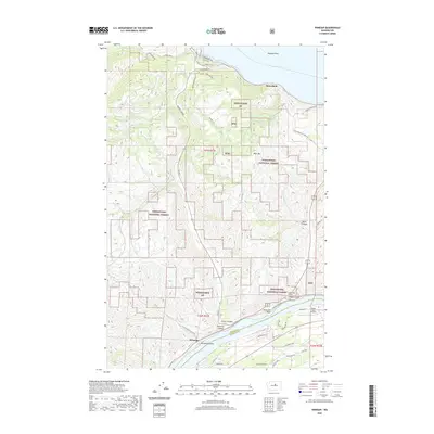
2020 Map of Winesap
USGS Topo · Published 2020About this map
Lake Chelan and Lake Entiat anchor this modern landscape in Chelan County, where the southern tip of one of Washington's most famous natural lakes meets the regulated waters of the Columbia River. The small settlement of Winesap sits near the mouth of Oklahoma Gulch, reflecting a history tied to the regional agriculture and transportation corridors that navigate the steep breaks above the river. The terrain is marked by significant geological features like Navarre Coulee and Knapp Coulee, which serve as natural passages through the high ridges.
Find a feature on this map
49 named features on this map. Tap any name to fly to it.
Don’t see what you’re looking for? This feature index may not catch every label — zoom into the map to look around manually.
Map Details
Editions of this 2020 Winesap Map
This is the sole edition of this map. No revisions or reprints were ever made.
Other maps of this area

1901 · Chelan
USGS Topo · 1:125,000

1957 · Wenatchee
USGS Topo · 1:250,000

1968 · Chelan
USGS Topo · 1:24,000

1968 · Waterville
USGS Topo · 1:24,000
1968 · Cooper Ridge
USGS Topo · 1:24,000

1968 · Entiat
USGS Topo · 1:24,000
1968 · Stormy Mtn.
USGS Topo · 1:24,000

1968 · Ardenvoir
USGS Topo · 1:24,000

1968 · Baldy Mtn
USGS Topo · 1:24,000

1968 · Winesap
USGS Topo · 1:24,000