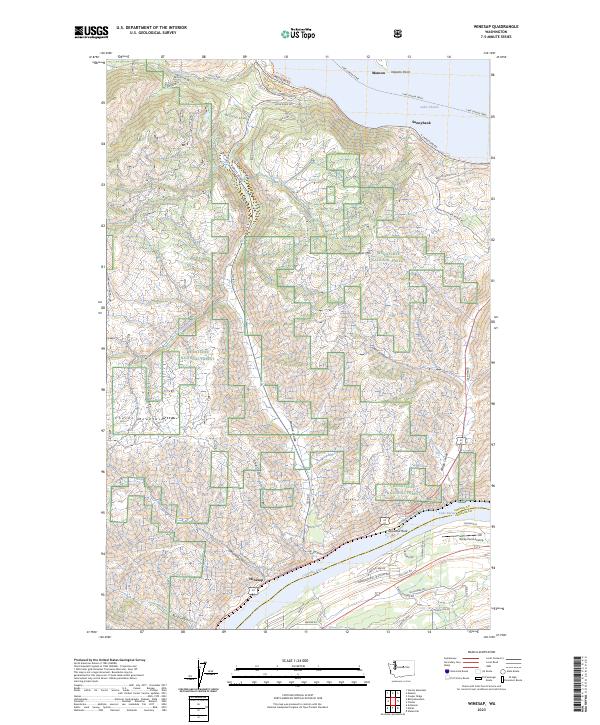
2023 Map of Winesap
USGS Topo · Published 2023About this map
Lake Chelan dominates the northern reaches of this landscape, where the Lake Chelan Ferry provides a vital transit link between Manson and the south shore. This region is defined by its dramatic elevation changes, rising from the Columbia River and Lake Entiat in the southeast toward the heights of the Chelan Mountains. The settlement at Winesap sits nestled between Oklahoma Gulch and Byrd Canyon, illustrating the historical reliance on narrow coulees for passage through the steep terrain. Land use here is a patchwork of agricultural development near Sunnybank and the protected wilderness of the Wenatchee National Forest. Key landmarks such as Goosetail Rock and the Rocky Pond Airstrip offer unique orientation points for researchers tracing the modern infrastructure and natural geography of Chelan County.
Find a feature on this map
48 named features on this map. Tap any name to fly to it.
Don’t see what you’re looking for? This feature index may not catch every label — zoom into the map to look around manually.
Map Details
Editions of this 2023 Winesap Map
This is the sole edition of this map. No revisions or reprints were ever made.
Other maps of this area

1901 · Chelan
USGS Topo · 1:125,000

1957 · Wenatchee
USGS Topo · 1:250,000

1968 · Chelan
USGS Topo · 1:24,000

1968 · Waterville
USGS Topo · 1:24,000
1968 · Cooper Ridge
USGS Topo · 1:24,000

1968 · Entiat
USGS Topo · 1:24,000
1968 · Stormy Mtn.
USGS Topo · 1:24,000

1968 · Ardenvoir
USGS Topo · 1:24,000

1968 · Baldy Mtn
USGS Topo · 1:24,000

1968 · Winesap
USGS Topo · 1:24,000