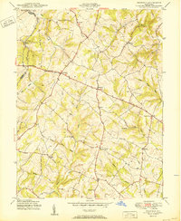
1950 Map of Winfield
USGS Topo · Published 1950About this map
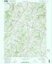
Parrs Ridge serves as the geographical spine of this central Maryland landscape, dividing the drainage patterns between several significant waterways. Small rural settlements and crossroads hubs define the mid-century social geography, with Winfield and Taylorsville emerging as central points along the ridge-line road networks. The map documents an era of dispersed agricultural life, evidenced by the numerous named crossroads such as Covers Corner, Dorsey Crossroads, and Picketts Corner. Educational infrastructure of the period is represented by the Woodbine Sch in the southern portion of the quadrangle. A network of stream branches, including Gillis Falls, Morgan Run, and Cabbage Spring Branch, carves through the undulating terrain, illustrating the natural water resources that shaped early settlement patterns and property lines across the Carroll and Frederick County border.
Find a feature on this map
28 named features on this map. Tap any name to fly to it.
Don’t see what you’re looking for? This feature index may not catch every label — zoom into the map to look around manually.
Map Details
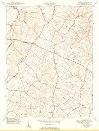
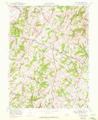
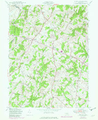
Editions of this 1950 Winfield Map
5 editions found
Other maps of this area

1892 · Ellicott
USGS Topo · 1:62,500

1893 · Frederick
USGS Topo · 1:125,000

1894 · Ellicott
USGS Topo · 1:62,500

1894 · Frederick
USGS Topo · 1:125,000

1905 · Westminster
USGS Topo · 1:62,500

1906 · Ellicott
USGS Topo · 1:62,500

1908 · Patapsco
USGS Topo · 1:125,000

1909 · Mount Airy
USGS Topo · 1:62,500

1911 · Taneytown
USGS Topo · 1:62,500

1942 · Gettysburg
USGS Topo · 1:125,000
Featured Places
- Braddock Manor West, MD
- Oceola Estates, MD
- Rolling Hills, MD
- Rolling Carroll Estates, MD
- River Wood Hills, MD