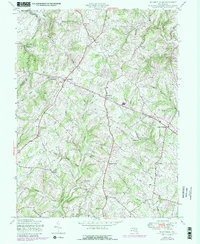
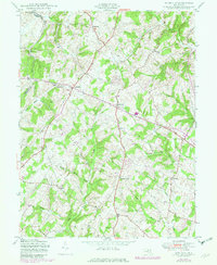
1950 Map of Winfield
USGS Topo · Published 1979About this map
Parrs Ridge serves as the prominent topographic spine of this region, dividing the landscape where Frederick and Carroll counties meet. This mid-century survey, updated in the late 1970s, reveals a rural Maryland landscape defined by dispersed crossroads settlements and family-named landmarks. Small hubs like Winfield, Taylorsville, and Franklinville anchor the road network, while the southern portion of the sheet features the Woodbine Sch and quiet junctions such as Picketts Corner and Dorsey Crossroads. The intricate drainage pattern is marked by numerous waterways including Morgan Run and Gills Falls, which have shaped the rolling valley floor. The inclusion of the Morgan Run Environmental Area highlights the transition toward land preservation in an area historically dominated by agriculture and localized trade along these winding country routes.
Find a feature on this map
28 named features on this map. Tap any name to fly to it.
Don’t see what you’re looking for? This feature index may not catch every label — zoom into the map to look around manually.
Map Details
Editions of this 1950 Winfield Map
5 editions found
Other maps of this area

1892 · Ellicott
USGS Topo · 1:62,500

1893 · Frederick
USGS Topo · 1:125,000

1894 · Ellicott
USGS Topo · 1:62,500

1894 · Frederick
USGS Topo · 1:125,000

1905 · Westminster
USGS Topo · 1:62,500

1906 · Ellicott
USGS Topo · 1:62,500

1908 · Patapsco
USGS Topo · 1:125,000

1909 · Mount Airy
USGS Topo · 1:62,500

1911 · Taneytown
USGS Topo · 1:62,500

1942 · Gettysburg
USGS Topo · 1:125,000
Featured Places
- Braddock Manor West, MD
- Oceola Estates, MD
- Rolling Hills, MD
- Rolling Carroll Estates, MD
- River Wood Hills, MD