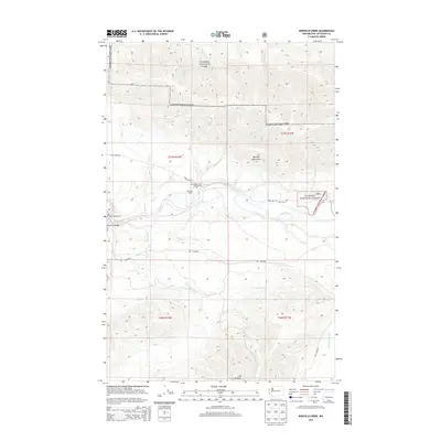
2014 Map of Winfield Creek
USGS Topo · Published 2014About this map
The Hoh River corridor defines this portion of the Olympic Mountains in Jefferson County, where the waterway meanders through the protected wilderness of Olympic National Park. This 2014 survey illustrates the intersection of public land management and private legacy holdings, notably the Schmidt Ranch and Fisher Ranch situated along the Upper Hoh Rd. The map documents the intricate network of glacial and mountain runoff, including the Snahapish River and multiple named creeks like Winfield Cr and Elk Cr. For those studying the geography of the Olympic Peninsula, the map shows key access points such as the Hoh River Bridge and the Willoughby Creek Campground, alongside prominent peaks like Mt Octopus. The landscape is a mix of rugged peaks and river valleys, framed by the administrative boundaries of Olympic National Forest.
Find a feature on this map
30 named features on this map. Tap any name to fly to it.
Don’t see what you’re looking for? This feature index may not catch every label — zoom into the map to look around manually.
Map Details
Editions of this 2014 Winfield Creek Map
This is the sole edition of this map. No revisions or reprints were ever made.
Other maps of this area

1939 · Forks
USGS Topo · 1:62,500

1943 · Spruce Mountain
USGS Topo · 1:62,500

1943 · Copalis Beach
USGS Topo · 1:250,000

1951 · Copalis Beach
USGS Topo · 1:250,000

1956 · Destruction Island
USGS Topo · 1:62,500

1956 · Spruce Mtn.
USGS Topo · 1:62,500

1956 · Salmon River
USGS Topo · 1:62,500

1957 · Forks
USGS Topo · 1:62,500

1957 · Copalis Beach
USGS Topo · 1:250,000

1963 · Copalis Beach
USGS Topo · 1:250,000