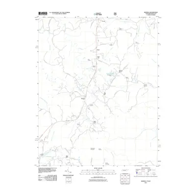
2010 Map of Winfield
USGS Topo · Published 2010About this map
The State Line between Tennessee and Kentucky marks the northern reaches of this area, where the terrain transitions into the steep drainage basins of Roaring Paunch Creek and Marsh Creek. In the early 21st century, the settlement of Winfield serves as a primary hub, situated along the corridor that connects to Isham and Strunk. The landscape is notably defined by its many family-named burial grounds, including the Chitwood Cemetery and Stephens Cemetery, which provide vital touchpoints for local genealogical research. Water management is evident through the presence of Ronald King Lake and its associated Ronald King Dam, while the high ground of Honeycutt Mountain and Privet Mountain anchors the southern portion of the map. This survey detail captures a community deeply integrated with its geography, from the small clusters at Piney Grove to the remote reaches of Wilson Holler.
Find a feature on this map
67 named features on this map. Tap any name to fly to it.
Don’t see what you’re looking for? This feature index may not catch every label — zoom into the map to look around manually.
Map Details
Editions of this 2010 Winfield Map
This is the sole edition of this map. No revisions or reprints were ever made.
Other maps of this area

1890 · Williamsburg
USGS Topo · 1:125,000

1893 · Briceville
USGS Topo · 1:125,000

1894 · Williamsburg
USGS Topo · 1:125,000

1895 · Wartburg
USGS Topo · 1:125,000

1895 · Briceville
USGS Topo · 1:125,000

1896 · Wartburg
USGS Topo · 1:125,000

1896 · Briceville
USGS Topo · 1:125,000

1934 · Barthell
USGS Topo · 1:62,500

1936 · Pioneer
USGS Topo · 1:24,000
1946 · Pioneer
USGS Topo · 1:24,000