2022 Map of Winfield
USGS Topo · Published 2022About this map
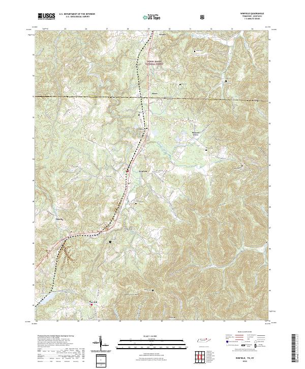
The town of Winfield sits at the heart of this landscape, positioned where the high plateaus of Tennessee meet the Kentucky border. This modern survey illustrates a rugged topography defined by the drainage basins of Roaring Paunch Cr and Jellico Cr, which carve deep valleys between ridges like Honeycutt Mtn and Privet Mtn. The northern reaches of the map include a portion of the Daniel Boone National Forest and the community of Strunk, while the southern end captures the northern outskirts of Oneida and Pine Hill.
Find a feature on this map
94 named features on this map. Tap any name to fly to it.
Don’t see what you’re looking for? This feature index may not catch every label — zoom into the map to look around manually.
Map Details
Editions of this 2022 Winfield Map
This is the sole edition of this map. No revisions or reprints were ever made.