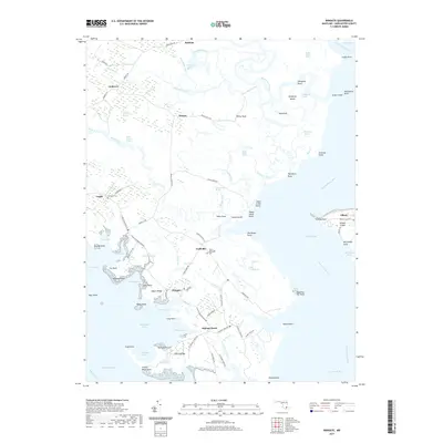
2019 Map of Wingate
USGS Topo · Published 2019About this map
Elliott Island and the interconnected marshlands of Dorchester County define this coastal landscape, where the land fragmentizes into countless coves and points along the Chesapeake Bay. Small maritime communities like Toddville, Wingate, and Bishops Head are tied together by narrow roads such as Toddville Rd and Bishops Head Rd, which navigate the edges of the Great Marsh and Beech Ground Swamp. The map documents a fragile geography where water bodies like the Blackwater River and Transquaking River dominate the interior, leaving only thin ridges of habitable ground.
Find a feature on this map
106 named features on this map. Tap any name to fly to it.
Don’t see what you’re looking for? This feature index may not catch every label — zoom into the map to look around manually.
Map Details
Editions of this 2019 Wingate Map
This is the sole edition of this map. No revisions or reprints were ever made.
Other maps of this area

1898 · St. Marys
USGS Topo · 1:125,000

1903 · Nanticoke
USGS Topo · 1:62,500

1903 · Bloodsworth Island
USGS Topo · 1:62,500

1903 · Deal Island
USGS Topo · 1:62,500

1905 · Crapo
USGS Topo · 1:62,500

1906 · St. Marys
USGS Topo · 1:125,000

1942 · Bloodsworth Island
USGS Topo · 1:24,000

1942 · Richland Point
USGS Topo · 1:24,000
1942 · Honga
USGS Topo · 1:24,000

1942 · Deal Island
USGS Topo · 1:24,000