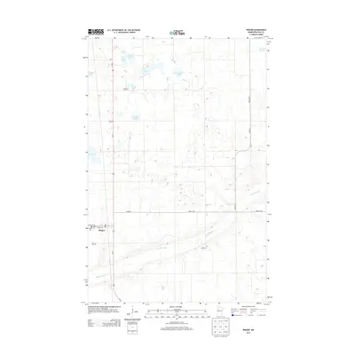
2013 Map of Winger
USGS Topo · Published 2013About this map
Winger serves as the primary hub of this northwestern Minnesota landscape, situated where Us-59 intersects 435th St SE. The area is characterized by a high density of small lakes and wetlands, typical of the regional geography, including Engemoen Lake, Hedman Lake, and the aptly named Tee Lake. These water bodies are interspersed with a regular grid of section roads like Co Hwy-1 and 275th Ave SE.
Find a feature on this map
28 named features on this map. Tap any name to fly to it.
Don’t see what you’re looking for? This feature index may not catch every label — zoom into the map to look around manually.
Map Details
Editions of this 2013 Winger Map
This is the sole edition of this map. No revisions or reprints were ever made.
Other maps of this area

1919 · Valley
USGS Topo · 1:62,500

1952 · Grand Forks
USGS Topo · 1:250,000

1954 · Bemidji
USGS Topo · 1:250,000

1956 · Grand Forks
USGS Topo · 1:250,000

1957 · Bemidji
USGS Topo · 1:250,000

1958 · Bemidji
USGS Topo · 1:250,000

1966 · Grand Forks
USGS Topo · 1:250,000

1966 · Union Lake
USGS Topo · 1:24,000
1966 · Erskine
USGS Topo · 1:24,000
1966 · Faith NE
USGS Topo · 1:24,000