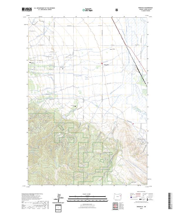
2023 Map of Wingville
USGS Topo · Published 2023About this map
Baker Valley is defined by a sophisticated network of irrigation and water management, visible through features like Phillips Ditch, Payton Ditch, and the Baker Municipal Aqueduct. This agricultural landscape, primarily north of the Elkhorn Mountains, is anchored by the settlement of Wingville. For genealogists, the map preserves several significant burial sites, including the Wingville Cem, Pocahontas Cem, and the small Williams Gravesites located along Michael Ln. The southwestern portion transitions into the high terrain of the Whitman National Forest, where deep canyons like Dutch Gulch and Rouen Gulch cut into the mountainside. The distribution of reservoirs and ponds, such as Butler Reservoir and De Vos Pond, highlights the intensive water engineering required to sustain this part of Baker County.
Find a feature on this map
61 named features on this map. Tap any name to fly to it.
Don’t see what you’re looking for? This feature index may not catch every label — zoom into the map to look around manually.
Map Details
Editions of this 2023 Wingville Map
This is the sole edition of this map. No revisions or reprints were ever made.
Other maps of this area

1901 · Baker City
USGS Topo · 1:125,000

1901 · Sumpter
USGS Topo · 1:125,000

1955 · Baker
USGS Topo · 1:250,000

1955 · Canyon City
USGS Topo · 1:250,000

1959 · Baker
USGS Topo · 1:250,000

1959 · Canyon City
USGS Topo · 1:250,000

1967 · Baker
USGS Topo · 1:24,000
1967 · Haines
USGS Topo · 1:24,000
1967 · Magpie Peak
USGS Topo · 1:24,000

1967 · Blue Canyon
USGS Topo · 1:24,000